You can view the magazine articles that have resulted from this trip over in the articles section of this site
A Ride Along the Eastern Sierras
From sea level to 8,650ft. From 2C to 36C
‘***K, Geoff, this is not good. … I can’t see anything!’
‘Can you see the yellow line down the middle of the road ?’
‘Well.., yes’
‘That’s all you need to see ..’
 Freezing fog on Carsons Pass
A short snippet of our bike to bike communication whilst riding Carson’s Pass in freezing fog on day two of a seven day tour in the Eastern Sierras in May this year. But I’m getting ahead of myself so let’s go back to the beginning.
We had planned a big trip to California and Hawaii using a wedding anniversary and a birthday as an excuse for what was going to be an expensive trip. Part of this trip was a seven day tour on two motorbikes from San Francisco to Los Angeles via the Eastern Sierras.
Our planned route was to take the Tioga pass through Yosemite then along the other side of the Sierras taking in Mono Lake etc. (See route map). By the time we boarded our flight to SanFrancisco we already knew the Tioga Pass was closed due to exceptional snow falls.
We were forced to take the one route still open. We would go further north to Lake Tahoe via the Carson and Luther passes. This would add around 400km to the journey and use up the free day we had planned to spend in Yosemite .

We pitched up at MotoQuest (thoroughly recommended if you want to rent bikes for a similar tour) on Treasure Island, half way along the Oakland Bay Bridge, in a taxi wearing all our biking gear and carrying four pannier inner bags, a Kriega wet bag and an array of cameras, batteries, mounting options and tools. In typical laid-back California style the guys at MotoQuest were completely relaxed with us adding whatever we wanted to the bikes, two brand new Suzuki V-stroms , and left us to our own devices to rig up things as we wanted them.

 Kitting up the bikes at Motoquest on Treasure Island
We soon found ourselves under leaden skies making our way with aching clutch hands across the seemingly endless chessboard of strip malls and traffic lights that is the low-rent, once high-crime capital, of the bay area known as Oakland. Our adventure had begun.
After a few long hours we finally escaped the built up areas of the city and found ourselves passing through rolling golden hills of sunburnt grass, dotted with emerald trees, under what was now a cloud scudded beautiful big sky. It wasn’t to last.
 As the day progressed the horizon was getting progressively blacker and blacker and we were heading straight for it. We pulled over onto the red earth alongside a fruit tree plantation and donned wet weather gear. Just in time.

 Rain is on the way !
California is a land of extremes and we were about to experience one of the less enjoyable ones. Barely five minutes later we were battling through tracer bullet rain and gusting wind against a Mordor-like backdrop illuminated only by periodic tree-like flashes of lightning lacing the black velvet sky. We got very, very wet. Very, very quickly.
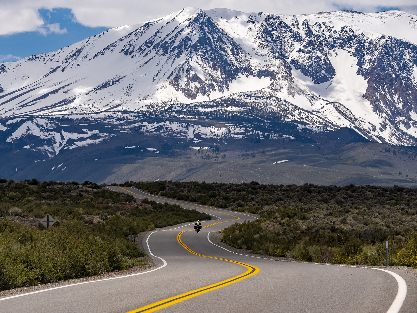
Day two saw us, damp and bedraggled, albeit under blue skies once again, heading towards Jamestown along undulating roads lined on both sides with endless fruit tree plantations and Tuscan villa style ranches with poplar lined entrance drives. After Jamestown the scenery changed to gently winding lanes through overhanging trees and occasional ship-lap homesteads complete with white picket fences and swinging veranda chairs. At Jackson a right turn saw us on highway 88, the start of the Carson Pass.
Due to excessive snowfalls this was the only route open to us in order to get to the other side of the Sierras. It’s not the route you would pick in good weather as it’s relatively straight and not so interesting to ride as the others but we had no choice.
Well before we reached the summit of the pass at 8500 ft we had entered the clouds and visibility dropped to almost zero. Only the prominent yellow line down the middle of the road and the fact that there were no hairpins made it possible to ride at all. As we got higher and higher the temperature dropped to just above freezing. There were no other motorbikes on the road, nobody would be so stupid, only the occasional car looming out of the mist with yellow flashers blinking. It was monotonous, cold and mesmerising. We were praying that we were sufficiently visible from behind, whilst reminiscing about that scene in the Jim Carey movie ‘Dumb and Dumber’ where the pillion passenger froze to the rider.


If you can see the yellow line it’s enough!
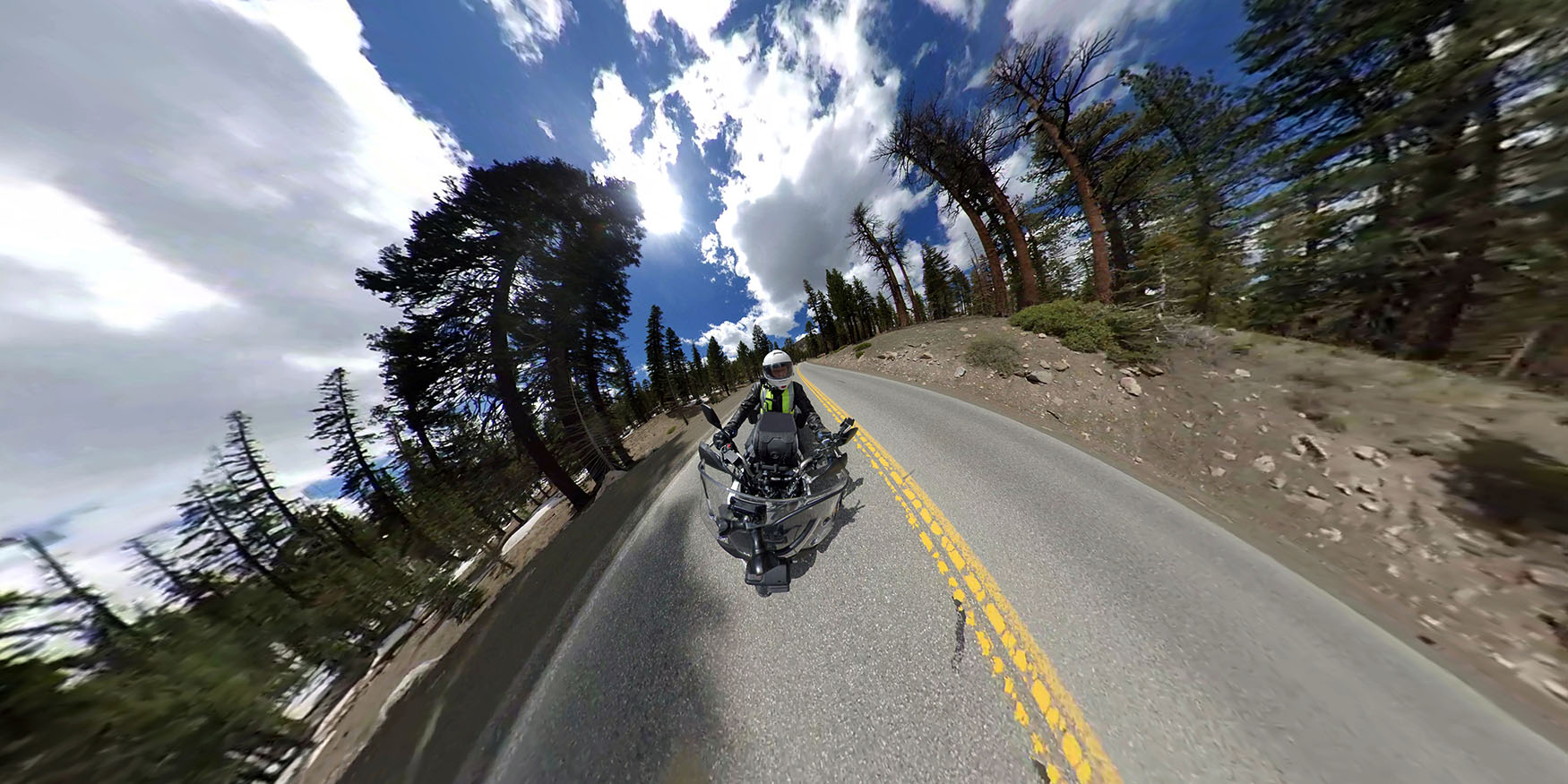
Not even heated vests, winter gloves and thermal underwear could stop the penetrating damp and cold. I had started this section of the ride with two cameras running but by the time we eventually emerged from the clouds, thankful and shivering, they had both packed up. We rewarded ourselves in South Lake Tahoe that evening with a wonderful meal and a bottle of wine in a superb little boutique restaurant called Cafe Fiori. They even had Earl Grey tea to finish.


Brrr..
The next morning started overcast and dull but was cheered up by a superb omelette breakfast in Heidis Pancake House. The sky gradually cleared to a cloud scudded blue as we made our way south along the Nevada section of highway 395, an unremarkable straight line through scrub flatland towards the distant hills and Topaz Lake. After a quick coffee in the Topaz Lodge Casino we continued on to Bridgeport. On the way we couldn’t resist taking a diversion along the Sonora Pass to see how far we could get before it was closed. A very pleasant ride along the West Walker river towards snow capped peaks ahead was brought to an end after only about five miles at a barrier just after a Marine Corps Mountain Warfare training centre.
 Sonora Pass is closed
In Bridgeport we refuelled. Both the bikes and ourselves. The Shell garage at the start of town followed by The Sportsmen’s Bar and Grill directly opposite the imposing Italianate Superior Court building in the centre. I got chatting to a gravel voiced biking enthusiast in the car park out front and he told me all about the nearby gold rush ghost town of Bodie.
We decided to visit it after our ‘healthy’ lunch of a triple decker club sandwich with fries and cokes. An American staple.
Continuing south on the 395, Bodie State Park is reached via a left turn on the 270 which goes for ten miles with tarmac then a further three as an unmade road. As we paid our $8 entrance fee to the park warden she quipped with a grin “We don’t see many motorbikes down here”


 The ruins of Bodie – Ghost Gold Rush town
After several fascinating hours amongst the remnants of this once booming town ( see side bar) we headed back up the unmade road and down to our overnight stop at the quaint Gateway Motel in Lee Vining on Mono Lake. This sleepy one road town of only 300 inhabitants was all but closed at this time of year and as the only hotel guests we got the upstairs suite with a veranda overlooking the Lake below. Directly across the street was the only place open to get some food, the delightfully home-spun Bodie Mike’s where we enjoyed Ribs and Jacket potatoes.
The next morning we awoke to our first really sunny day. White fluffy cotton wood seeds were blowing all around us as we crossed the street for breakfast. Soon we were back on the Stroms, standing on the pegs as we gingerly rolled down a loose gravel path to the shore of Mono Lake.
 We paid our $3 visitor fee and left our tank bags with the warden. This place is an unmissable surreal land/waterscape of towering alien formations reflected in the shimmering surface of the saline lake. You can easily lose yourself, and many hours, exploring and photographing this unique location. Which we did!


An unmissable surreal land/waterscape of towering alien formations
 We were well behind schedule when we finally left this magical place and headed off on our route to Lone Pine after another little side excursion into Tioga Pass. This was the pass we had wanted to take when we first planned the trip and we were determined to try to get a feel for the Yosemite we had missed. We just got far enough to shoot some sequences riding through the Redwoods before we were once again stymied by a road barrier.
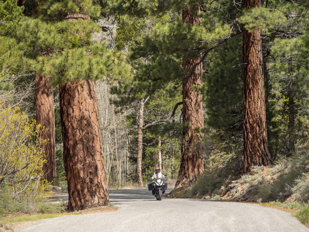
Liz riding the Redwoods
Today was becoming one of those rides where the incidental, unplanned, changes to the route would prove to be the best bits. There would be two more great side loops before we finally got to Lone Pine. A right turn off the 395 saw us on a 13 mile loop around the Grant, Silver, Gull and June lakes. A deserted road led us away from the highway through relatively barren scrubland and along the shore of Grant Lake, the largest of the four.
The scenery soon changed dramatically as the road passed the lake and entered a steep sided, tree lined valley leading past Silver Lake to the June Mountain ski area then looping back, past the remaining lakes, through forest scenery reminiscent of our home in Austria.
A further ten miles south on the 395 brought us to the Mammoth Lakes scenic loop.
 Winding its way through sweet smelling pine forest with footings covered in snow there were no wide open scenic views here, but we enjoyed riding this loop even more than the last one. A brief stop for lunch at the imaginatively named ‘Burgers Restaurant’ in Mammoth Lakes set us up for the remainder of the ride. A hot and sticky 100 miles south through a huge flat basin with the distant Sierras to the right and Death Valley to the left. This is cruise control and squared-off tyre territory. The scenery changes so imperceptibly slowly you would need a fast time-lapse to notice any change at all. Time to enjoy our Spotify music playlists.

The scenery changes so imperceptibly slowly you would need a fast time-lapse to notice any change at all
We overnighted at the Comfort Inn in Lone Pine (well – no Pine now – as the Lone Pine blew down in the great storm of 1876) and enjoyed Elk steaks at the ‘Seasons’ restaurant. Another great day!
The next day’s route would take us down to Bakersfield, but not before visiting the excellent Museum of Western Film History just along the road from our hotel. This museum is dedicated to the over 800 cowboy films and countless tv shows made in the Alabama hills behind the museum. The most recent of note being Quentin Tarrantino’s Django Unchained. Surprisingly for a location so far from the sea, these hills were named ‘The Alabama Hills’ in honour of the Confederate warship, CSS Alabama, by prospectors sympathetic to the cause.The ship was actually constructed at Birkenhead on the English River Mersey and finally sunk off the coast of Normandy in 1864.

Museum of Western Film History

The Lone Ranger

The Singing Cowboys

The dentists wagon from ‘Django Unchained’
After an hour or so visiting this nostalgia trip of a museum we headed off into the hills to absorb some authentic cowboy atmosphere. Having been brought up watching The Lone Ranger, Hop-along Cassidy and Bonanza, as well as countless John Wayne and Randolph Scott westerns it was impossible to not imagine shootouts, stagecoach hijacks and Apache Indian encampments behind the rounded rocks and in the sandy depressions between the contours of this amazing place. The contrast between this smoothly eroded maze of reddish sandy rocks and arches seen against the snow capped jagged massive of Mount Whitney (at 14,505 ft the tallest mountain in the Contiguous US) is starkly beautiful and was used to great effect in all those historic Westerns.


In the Alabama Hills of ‘Lone Ranger’ fame
The hilly area used for filming is surprisingly small in reality and the road soon leads through it and heads off across the scrub desert plain to the Whitney Portal, but not until you pass a sign warning that you are entering an ‘ActiveBear Area’.
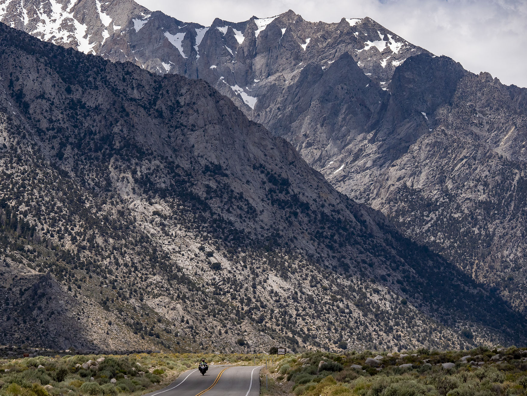
 As you ride closer towards Mount Whitney it rises and rises above you as the awesome giant it is.
 The road then climbs up sharply and has a single left hairpin turn with a spectacular view across the Owens Valley floor and the Alabama hills behind.
 After a stretch with loose rubble spilling onto the road from the right and sheer drops on the left, you pass through a forested area to arrive at the Whitney Portal. Here at 8,374 ft you must turn back unless proceeding on foot by the Mount Whitney Trail. We did the former.

Looking back to the Alabama Hills from the Whitney Portal road
We’d had so much fun in the museum and the Alabama hills that the morning had already flown away. It was lunchtime before we even got back to Lone Pine. We grabbed a surprisingly good toasted ham and cheese sandwich at the Chevron petrol station and wolfed it down sitting on the curb in the parking lot. Sometimes these are the best meals of all.

Sometimes these are the best meals of all.
There followed another mesmerisingly straight, hot (35c) and seemingly never ending ride down the 395 with the Sierras on our right getting gradually smaller and smaller the more south we got, and the nothingness of Death Valley to the left. A different Spotify selection was in order.
We eventually sweated our way to the Isabella Walker Pass road and, after a much needed ice cream at Brady’s Mini Mart, we headed west towards the hilly remnants of the Sierra mountains and Lake Isabella. This part of the ride would soon make the monotony of the previous hours well worth it. The scenery rapidly changed character from the flat desert scrub we were now so used to. At first it melded into gently rising slopes on either side of the road with more dense bushy scrub and stunted fir trees. Then as we progressed ever westward we went through more forest sections followed by huge areas dominated by Joshua trees and scattered cacti. The right hand side of the road would often change abruptly to a lush dense green vegetation whenever it got close to Canebrake Creek.

Joshua Trees on the Isabella Walker Pass road
As we approached Lake Isabella and passed through Weldon, the scenery changed to cultivated farmland with crop fields and herds of cattle on either side of the tree-shaded road. A stark irrigated contrast to the barren backdrop of the sandy Sierra foothills all around. Some way past Lake Isabella we entered the final, and easily the best from a riding point of view, stage of todays route. The ride along the Kern River valley down to Bakersfield is spectacular. Winding and twisting our way along the valley floor with the raging rapids in full boiling flood to our right, it was a blast of a ride and a fitting end to another fantastic day of Californian experiences.


Kern River valley
The next morning was unremarkable as we left Bakersfield on straight highways and headed South West towards Maricopa before picking up the CA33 towards Ventura on the coast. This would be our last day before making our way into LA to return the bikes. On a hot, straight, featureless dusty section of the 33 between intermittent stops caused by numerous road resurfacing gangs, we pulled into a dusty parking space next to a lone Harley parked outside a small shack. Single story with a drystone wall frontage and a shiny new green pitched roof, it was grandly called ‘The Place’
There we ordered another American staple, a burger and fries, and got chatting to Wolfgang, the Harley rider. Wolfgang turned out to be a very experienced world tourer and motorcycling journalist from Germany. We swapped stories and route suggestions and he told us we were about to enter a really great section of the 33. He had just ridden it in the opposite direction.
Boy was he right. Barely a few miles further down the road the flat featureless scenery rapidly changed. Sandy hills and rocks, topped with green shrubs receding to trees, on either side of a twisting and turning, rising and falling, tarmac ribbon winding its way between the rolling hills of this section of the Los Padres National Forest. Probably not the most remarkable scenery of the trip but undoubtedly one of the best rides. Good tarmac and little to no traffic encouraged spirited riding and big grins all round. A great way to end this trip of a lifetime.


Los Padres National Forest – A great way to end this trip of a lifetime !
It only remained for us to fight our way through the sprawl of LA to return the bikes to MotoQuest.
